Oriëntatie
Uitleg MapRun
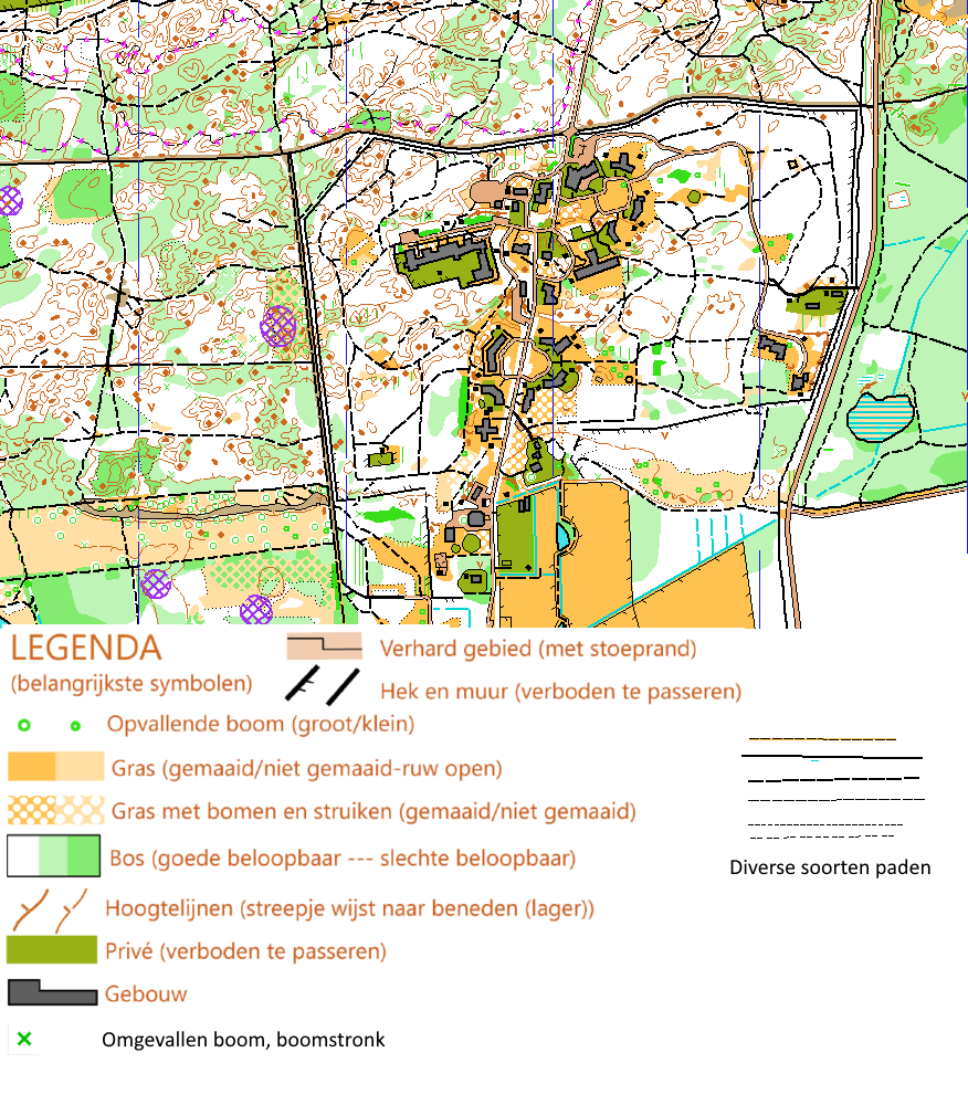
Overzicht van een kaart en de belangrijkste symbolen
De routes kunnen met een smartphone worden gelopen.
Zowel voor Android als voor de Iphone is een app te downloaden.
Codes voor downloaden routes:
|
Voorbeeld van kaart + legenda van belangrijkste symbolen.
Uitleg MapRun
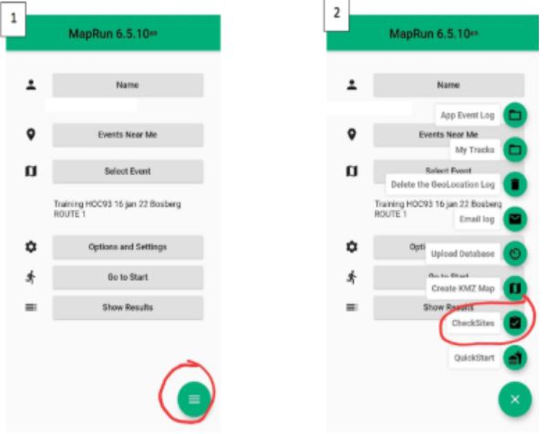
Download de app MapRun6 uit de AppStore of de Playstore. Vul je naam en enkele aanvullende gegevens in. Druk op het menubolletje rechtsonder (1) en kies voor Checksites (2).
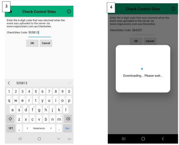
Vul de code in (3), Wacht een enkel ogenblik (4).
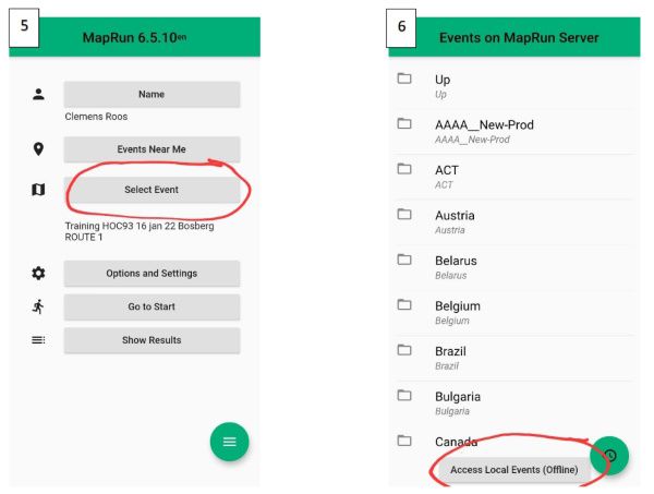
Kies nu Select Event (5). Kies vervolgens onderaan Access Local Events (Offline) (6). Een lijst met op je telefoon opgeslagen events verschijnt.
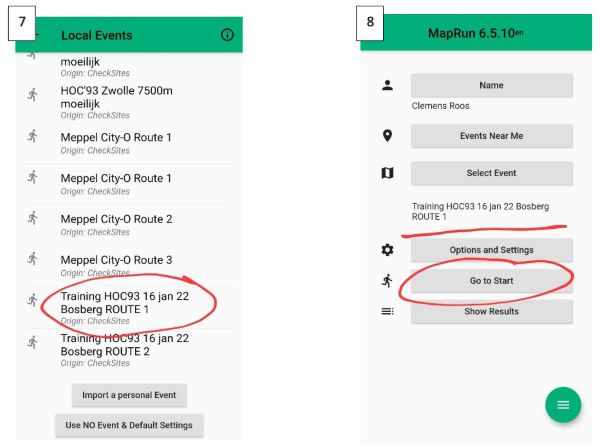
Heb je de app eerder gebruikt dan zie je zoals in deze afbeelding meerdere events (7). Druk op het event (training/route) die je nu wil (7). Je komt weer in het hoofdmenu. Het event dat je hebt gekozen staat nu midden in beeld. Druk nu op Go to Start (8)
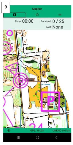
De kaart verschijnt (9). Als je dit thuis doet, zoom dan uit tot je woonplaats in beeld komt, dan zie je
daar het rode bolletje van jouw locatie. Doe je dit op de parkeerplaats dan moet het bolletje dus in
het beeld hieronder verschijnen. Loop naar de start en als je er klaar voor bent, loop dan ‘over’ de
start. Als alles goed werkt, krijg je een signaal en begint de tijdsregistratie. Kom je binnen een
bepaalde afstand (een paar meter) van de post dan krijg je weer een signaal. Loop je ‘over’ de finish
dan stopt de registratie. Naderhand kun je de resultaten bekijken.
Succes. Kijk evt. op https://maprunners.weebly.com/ voor meer info over de app. Je kan ‘m bijv. ook
gebruiken in combinatie met bepaalde Garmin Sporthorloges…
Als de route is gelopen en de finish is ook geregistreerd kan de route worden gedeeld.
Druk op de 3 streepjes rechtsboven, selecteer "Upload (Manual)".
"All results" geeft de overzichten van de diverse deelnemers.
Beschrijving van de posten in tekst. Op de pdf kaarten staat de uitleg met symbolen.
| ||||||||||||||||||||||||||||||||||||||||||||||||||||||||||||||||||||||||||||||||||||||||||||||||||||||||||||||||||||||||||||||||||||||||||||||||||||||||||||||||||||||||||||||||||||||||||||||||||||||||||||||||||||||||||||||||||||||||||||||||||||||||||||||||||||||||||||||||||||||||||||||||||||||||||||||||||||||||||||||||||||||||||||||||||||||||||||||||||||||||||||||||||||||||||||||||||||||||||||||||||||||||||||||||||||||||||||||||||||||||||||||||||||||||||||||||||||||||||||||||
